- Accueil
- Highlights Landing Page
- Uncover the Heritage of the Ballyhouras
Uncover the Heritage of the Ballyhouras
Ballyhoura
Patrimoine
Randonnée
Uncover the Heritage of the Ballyhouras
The Ballyhoura region is rich in folklore and heritage, from age-old settlements to bewitching goddesses.
Lough Gur
North of the Ballyhouras you will find the Neolithic heritage site of Lough Gur. Legend tells of Gearóid Iarla who was banished to the bottom of Lough Gur lake by the Goddess Áine. Every 7 years he resurfaces and tries to break the curse.
At the far side of the lake explorers will find Black Castle, a Norman castle associated with the Earl of Desmond dating back to the mid-1500s. Make sure to see the Stone Circle in Grange, the largest of its kind in Ireland.
Kilmallock
Kilmallock, Co. Limerick, is set in the valley of the River Loobagh and nestled at the foot of the Ballyhoura Hills to the south with the Galtee mountains to the east.
Kilfinane
Kilfinane is a small market town in the south east of County Limerick, nestled within the Ballyhoura Mountain range in the Golden Vale region; at 150 metres above sea level this town has picturesque views.
Doneraile
The busting town of Doneraile sits on the northern slope of Knockacur hill, which rises by a gentle slope from the Awbeg river, Doneraile is a vibrant town with a majestic history that can be witnessed through the presence of Doneraile Estate and Doneraile Wildlife Park. Discover the fascinating history of Doneraile and the peoples that resided within the big house with a guided tour of the estate, We are sure that you leave this town in awe of its grandeur and picturesque setting.
Historic Family Homes
Experience the utmost in Irish hospitality while touring the impressive Historical Irish Family Homes Castlegarde House, Grenane House, and Lismacue House. Your guide will transport you back in time as you explore the rich history of three landmark homes, revealing the fascinating untold stories of those who lived there long ago.
Mitchelstown
Mitchelstown is set at the foothills of the Galtee Mountains, in the beautiful countryside of Ireland's Blackwater Valley. The town's name derives from St. Michael, the patron saint of the Condon Family, who lived hereabouts in medieval times. It is an important example of a planned town and was laid out primarily by the 1st and 3rd Earls of Kingston in the late eighteenth and early nineteenth centuries.Their family, the King family, had acquired the town through the marriage of Sir John King, 1st Baron Kingston, to the heir of the Earl of Desmond's estates.
Mitchelstown is the ideal base from which to explore a wealth of activities available within the 'Three Counties' region of Cork, Limerick and Tipperary at the confluence of which the town lies. The town' s charming and picturesque 18-hole golf course is set at the foot of the Galtee Mountains. Pitch and Putt is on offer in part of the old grounds of the castle and at the lovely old village of Castlelyons.
The extensive local river network offers a wide choice of game and coarse fishing. Riding Tuition, Trail Riding and Pony Trekking are available at local equestrian centres. Mitchelstown lies in the valley between the Galtee and the Knockmealdown Mountains. Both offer spectacular scenery and can afford both the dedicated hill walker and the 'Sunday stroller' a huge variety of walks. The drive along the Blackwater Valley and around by 'The Vee' is one of the most beautiful drives in the country and lies at the town's doorstep. Download the historical map of Mitchelstown here; Mitchelstown Historical Map, There are many heritage highlights to visit in Mitchelstown including St. Fanachan's Well which goes back to pagan times, There is a lovely walk from Mitchelstown to this historical site.
In this Article...
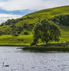
Lough Gur Heritage Centre
Activités en plein air
Activités
Visites et attractions
Ballyhoura
Voir Voir Destinations
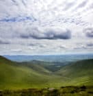
Ballyhoura CCE
Activités
Ballyhoura
Voir Voir Destinations
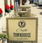
Café Townhouse
Nourriture et boisson
Ballyhoura
Voir Voir Destinations
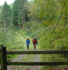
Ballyhoura Walks
Activités en plein air
Patrimoine
Balades
Ballyhoura
Voir Voir Destinations
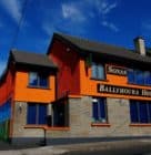
Ballyhoura Luxury Hostel
Aufenthalt
Ballyhoura
Voir Voir Destinations
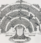
Irish Family Search
Patrimoine
Knockmealdown
Galtees
Ballyhoura
Nagles
Voir Voir Destinations

GREAT ARTitude Gallery
Activités
Visites et attractions
Ballyhoura
Voir Voir Destinations
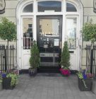
The Old Bank B&B
Aufenthalt
Ballyhoura
Voir Voir Destinations
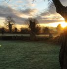
Say Hello to Ireland Tours
Patrimoine
Activités
Visites et attractions
Ballyhoura
Voir Voir Destinations


