
Coumduala Linear Walk
- Green Laneways
- Hillside Tracks
- mountain and upland terrain
- The Curraheen trailhead
Curraheen Trails - Three Linear Walks
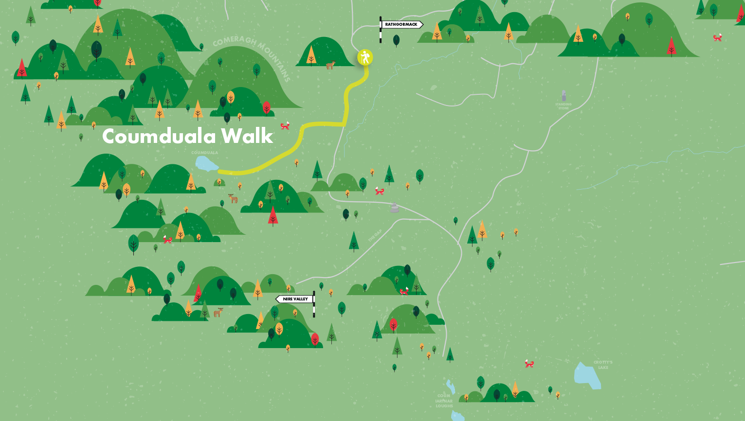
Rathgormack Hiking Centre has way marked some hill walks from Curraheen. Curraheen affords one of the most pleasant approaches to the north eastern Comeraghs and is an ideal starting point to explore the Gap, the Boolas and Coumduala.
Walk 7- Coumduala linear 5.5km 2.5hrs Follow the orange markers
Walk 8- The Gap linear 7km 3.5hrs Follow the white markers
Walk 9- The Boolas linear 9km 4hrs Follow the yellow markers
Coumduala Linear Walk -“Coumduala” means the hollow of the black cliffs. Although one of the Comeraghs’ loneliest and least known coums, it is well worth a visit.
Directions to Trailhead.
Start: To reach the Curraheen trailhead, follow the R678 west from the village for 3km to Clondonnell Cross. Turn left here and drive for a further 3km to a sharp right angled bend. Parking is available in an old farmyard 50 metres up the boreen.
A-B From the trailhead (S306154) follow the orange markers south along an old boreen for about 300 metres. Cross a stile, a couple of fields, another stile, one more field until you reach the open mountain after about 15 minutes. Drink in the views as the dramatic Knockanaffrin Ridge draws you on. The dip in the ridge on the left is the Gap. A large moraine obscures most of the impressive Coum Iarthar (Boolas) further left. Further left again is forested Graigavalla.
B-C To the right of the Gap is a large mound. This is the end moraine impounding Lough Coumduala and is your destination. Veer right when you exit onto the open mountain and keeping with the orange markers, you soon pick up a boundary wall which you follow uphill for about 200 metres (a headwater stream of the Clodiagh on your left goes all the way into the coum). Move to your right away from the wall now and continue climbing. After about 30 minutes you reach the first of Coumduala’s transverse moraines. Look behind you. Can you see Slievenamon and closer to you the sweep of the Rathgormack Plateau which blocks out the Suir Valley? Continue upward and soon you reach the inner moraine. Make your way to the lake by climbing past the small waterfall, keeping it to your left. This is arguably where the Clodiagh begins its journey.
C-A A walk around the lake should not be undertaken as cliffs reach down to the shore in places. The end moraine here is one of the most impressive in the Comeraghs, completely obscuring views of the valley below. When ready head down slope and return to the trailhead.

Munster Vales wishes to acknowledge funding received under ORIS for development of this campaign.