
Coumduala Loop Walk
- Mountain Terrain
- Upland
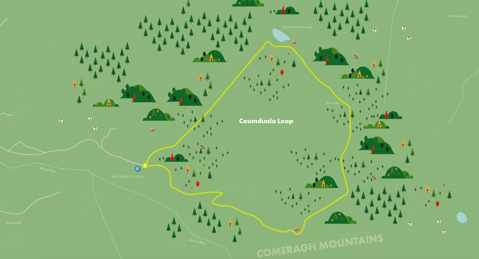
- Nire Valley Car Park
Coumduala Loop Walk - Nire Valley / Siúlóid Lúibe Chom Duala - Gleann na hUidhre
The Coumduala Loop Walk is a Fáilte Ireland National Looped Walking Trail. The trail is waymarked with purple markers, the purple route. This is the most difficult and the longest of the four waymarked Nire Valley walking trails. On this trail you will see Coumlara, a hollow with no lake as well as panoramic views of the surrounding counties from The Gap. In addition to these, this trail leads you up part of the Knockanaffrin Ridge and if visibility is clear you will also see the high peak of Slievenamon meaning “The Mountain of Women”.
Directions From Dungarvan follow the signs for the N72 West via the R672 (go through one roundabout). Continue onto the N72 for 300m and turn right onto the R672 just after the petrol station on your right. Continue onto the R671. Turn right toward Knockaun. Proceed along this road in an easterly direction for about 4km until you come to a bridge. At this point take the right fork before you cross the bridge and continue on for about a further 4km until you come to a car park (GPS: 52.267° N 7.595° W) on your left hand side.

Munster Vales wishes to acknowledge funding received under ORIS for development of this campaign.