
The Boolas Loop Walk
- Mountain
- Upland Terrain
- Green Laneways
- Hillside Tracks
- Curraheen Trailhead, Rathgormack
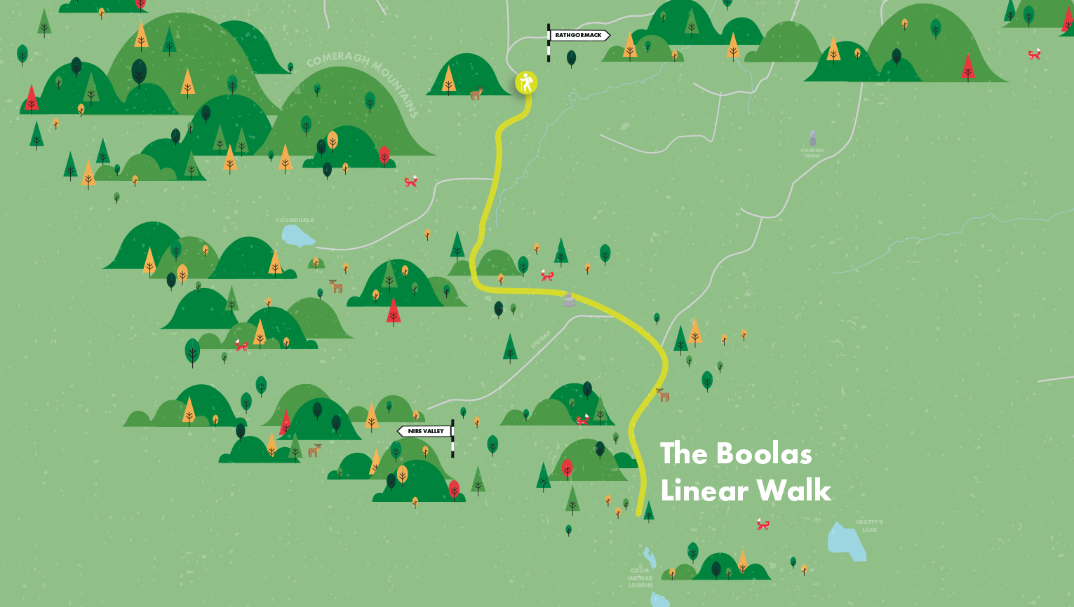
We Irish owe a debt of gratitude to geomorphologists like Frank Mitchell (“Reading the Irish Landscape”) for explaining the part played by natural forces such as glaciation in shaping our landscape features. This interesting walk links two of the most spectacular glacial features in the Comeraghs. At 1km in length, Coum Iarthar is the longest coum and houses the highest lake in the mountains and is known locally as the Boolas. A “buaile” in old Irish meant a summer herding place, usually in the hills. The term “Boolas” today refers to the four ribbon lakes in this beautiful coum. The Gap is a glacial col or saddle and serves as a high level pass between the Nire Valley and Rathgormack. The name “Bóithrín na Sochraide” on old maps indicates its use as a funerary path in the 18th and 19th centuries.
Directions to Trailhead.
Start: The trailhead is the same as for walks 7, 8, 9 – at Curraheen S306154.
A-B Follow the purple markers to the open mountain as per walk 7.
B-C Now turn left or south. Cross a couple of streams and when you reach the corner of Graigavalla forest, keep the trees on your left and you soon pass a huge boulder at the bottom of the Gap path. This, according to archaeologists, is possibly a Bronze Age cairn field site. Ahead, Crotty’s Rock and the large chasm of the Boolas loom large. Continue along the edge of the wood until you reach the Douglas stream.
C-D Turn right now and, keeping the water on your left, ascend for about 1km into the coum. When you reach the second lake the marked walk veers right. You may wish to follow sheep tracks across the moraine to explore the inner coum. The innermost Boola is the highest lake in the Comeraghs at 550 metres elevation.
D-E Make your way carefully to the mouth of the coum and follow the purple markers for 1.5 km, descending to the head of the Gap. Straight ahead the sinuous Knockanaffrin Ridge beckons. To your left (west) is the Nire Valley with Coumlara, Sgilloges, Coumalocha, and Coumfea in the distance to the south-west.
E-A When ready turn right and descend “An Staighre”, the rocky path of the old “Bóithrín na Sochraide” route north-east. Off to your left the highest point on the ridge above the forest is Knockanaffrin itself while the large mound protruding from the ridge is Coumduala. After about 1km you reach the huge boulder at the bottom of the Gap path. Turn left and follow the markers back to the trailhead.
Munster Vales wishes to acknowledge funding received under ORIS for development of this campaign.